In 1960 Pakistan and India signed the Indus Waters Treaty, which had been brokered by the World Bank to equitably redistribute waters of the Indus River and its tributaries between the two countries. The water dispute had its roots in the Partition of 1947 which had delimited India and Pakistan along religious lines, with little regard for geography. In particular, the headwaters of all these rivers happened to be located in India, giving it unilateral control over the rivers. The situation became even more urgent in the aftermath of the Indo-Pak War of 1948, during which India had temporarily blocked Pakistan’s access to the Indus. In this context, the link canals authorized by the Indus Waters Treaty offered to restore balance and stability to the region.
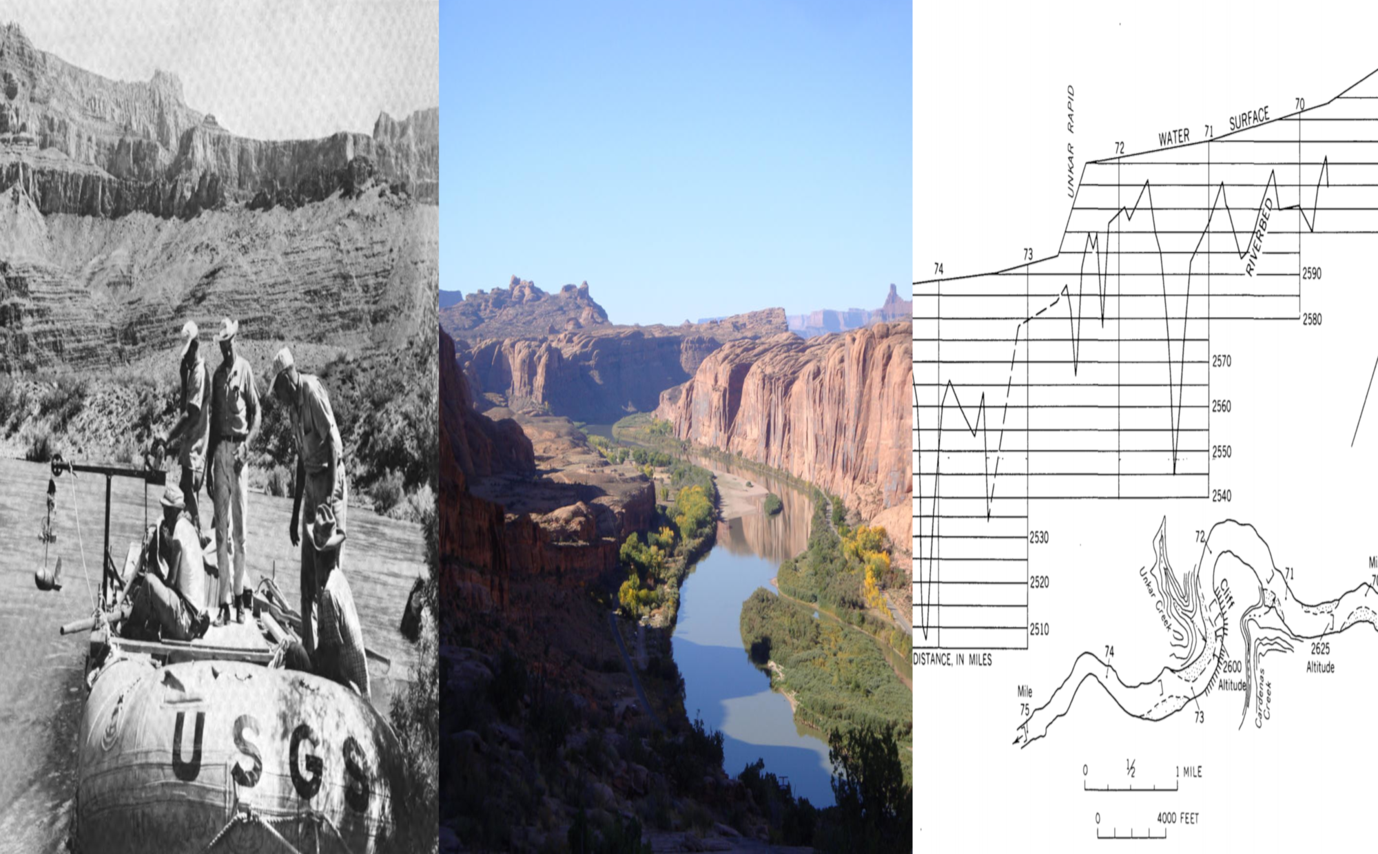
One of the hydraulic engineers who worked on the design of the link canals was Daryl Simons, a renowned hydrologist and fluvial geomorphologist. But before Simons worked with the World Bank on constructing these link canals, he was a graduate student at Colorado State University. There he came in contact with two hydrologists, Emory Lane and Whit Borland, who had both left the Bureau of Reclamation to teach at CSU and would serve on Simons’ dissertation committee. Lane and Borland were experts in regime theory, which states that canals have three degrees of freedom — depth, width and slope — and the task of the hydraulic engineer is to manipulate these dimensions in order to design a geomorphically “stable” canal, where there is no net erosion or deposition of sediment.
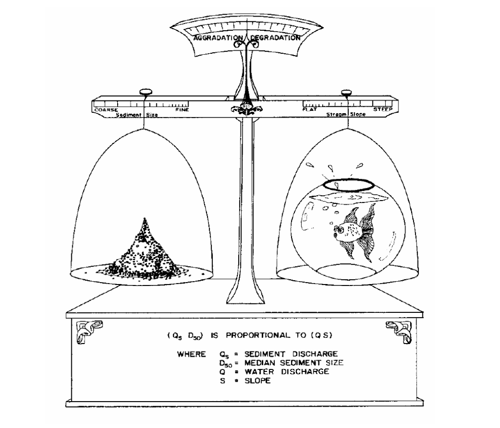
In 1955 Lane formalized this relationship between channel geometry and sediment load in his landmark equation QS ∝ QSD50, which states that water discharge (Q) and channel slope (S) are proportional to the quantity (QS) and grain-size (D50) of sediment load. When these two sets of factors are in balance, it creates what geomorphologists call “stability” in the channel. Conversely, when they are out of balance, the channel changes. For instance, if the channel slope is too steep, the rate of bed downcutting would be greater than the rate of sediment build-up, while a flat channel slope leads to the reverse.
In 1971 Borland gave this balancing act a visual form by creating a graph (see below) which was widely reproduced in geomorphology and hydrology textbooks, as well as in a 2005 article by Simons on his involvement with link canals in Pakistan and India. In particular, Borland’s diagram of Lane’s Balance captures the dynamic nature of geomorphic stability, according to which the balance is constantly tilting either to the left or right, with the channel adjusting its slope (and geometry) in response to changing sediment and water conditions.
Lane’s equation, and Borland’s visual representation of it, highlight how mid-century geomorphologists and hydrologists were increasingly using quantitative metrics such depth, slope and discharge to describe rivers. Indeed, Lane and Borland were two hydrologists among a constellation of many others with a quantitative bent, including Luna Leopold and Thomas Maddock, Jr. whose concept of “hydraulic geometry” similarly sought to capture the shifting balance of river form and behavior in quantitative terms.
But more broadly, the fact that Lane’s Balance is never really in balance but constantly teetering between the two extremes of aggradation and degradation attests to a cosmological shift that was underway in the mid-twentieth century, when the age-old static idea of nature’s balance was being reformulated in terms of cybernetic theories of self-regulating systems and feedback loops. Lane and Borland advanced a theory of river mechanics in which stability was not so much a permanent state as an aggregate one — the result of constant adjustment and readjustment of channel boundaries.
After completing his dissertation in 1957, Simons would apply this theory in South Asia to solve the practical problems of canal development that would allow Pakistan and India to equitably share the Indus River’s waters. He recommended installing such devices as sediment “excluders” and “ejectors” along the link canals in order to maintain dynamic equilibrium even under conditions of varying flow, since altering the slope and depth of these artificial canals after they had been built was out of the question. Thus, as sediment discharge was balanced by water flow, a kind of geopolitical balance was also being negotiated in the Indian subcontinent.